_7 pedestrian bridge
This solution connects the building to the higher level of the mountain in a straightforward way—through a bridge. As a result, the building itself has become a transitional structure, linking two different elevation levels. Instead of taking a long detour through the streets, people can simply use the building’s elevators to descend more efficiently.
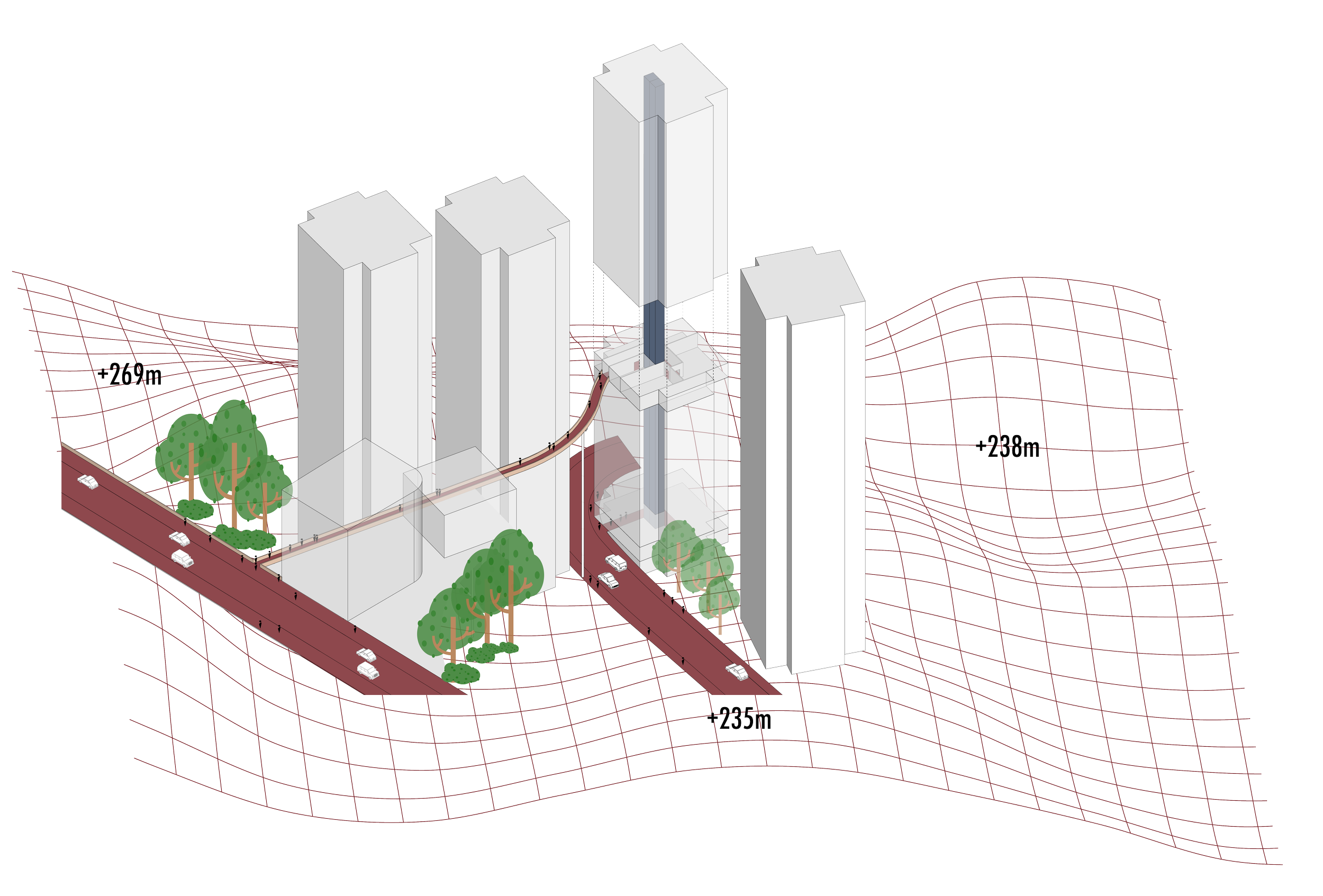

Since the bridge is located on the 15th floor, this level has naturally evolved into a public space with significant pedestrian traffic. In response, social and public services have been integrated into this floor, enhancing its functionality.
Beyond its practical role, the bridge has also become a tourist attraction, not only due to its simple yet effective design but also because of the panoramic views it offers over the city.
Lesson learned
Use building as a transport device for navigation through the city.